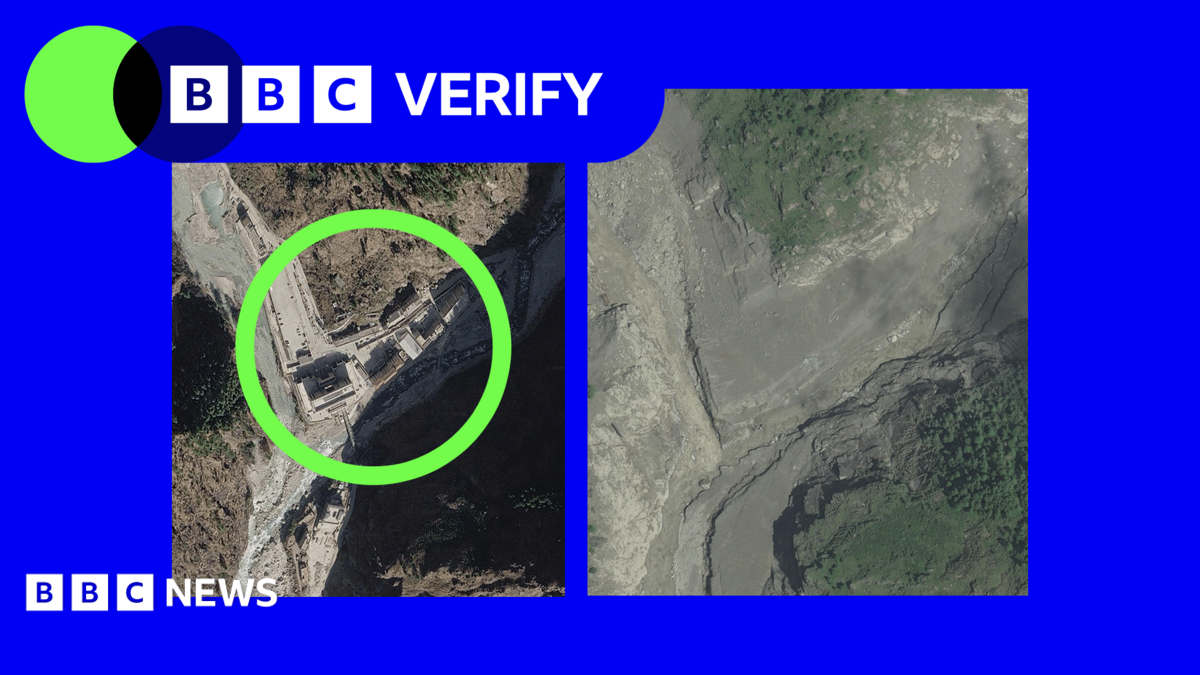
Satellite images reveal the scale of destruction along Nepal's Trishuli River. This was reported by Qazaqyia.kz citing BBC News.
The flash flood, triggered by a glacier collapse on Wednesday, destroyed villages, bridges and hydroelectric power stations. According to Nepalese officials, more than 550 people have been killed, with hundreds more missing.
BBC Verify analysts found that a key Nepal-Tibet border crossing was completely washed away. Satellite imagery from US-based firm Vantor shows the site of the disaster. Damage can be seen more than 2.5km upstream, reaching 100m in height.
The village of Timure has been largely destroyed. The valley walls rise up to 50m above the water line, with most houses now gone or covered in mud.
In Syapru Besi, bridges and a hydroelectric power station have been destroyed. In the town of Trishuli, an entire neighbourhood has been washed away. Witnesses captured on video a bridge collapsing and people trying to flee.
Satellite imagery from Planet Labs shows the glacier collapse. At the base of the landslide, vegetation has been stripped at a height of more than 300m. Chinese authorities have warned of the risk of a barrier lake forming.
According to glaciologist Dr Argha Banerjee from the Indian Institute of Science Education and Research, it is not possible to determine the stability of the barrier, but the lake's surface area has not changed significantly. He noted that some water is already escaping, and the volume appears to have stabilised.
Information about damage on the Tibetan side is limited, as foreign media access is heavily restricted. Vantor has published the satellite imagery as part of its Open Data Program.